Navon
Here to change the game forever
Precision. Beyond Reach.
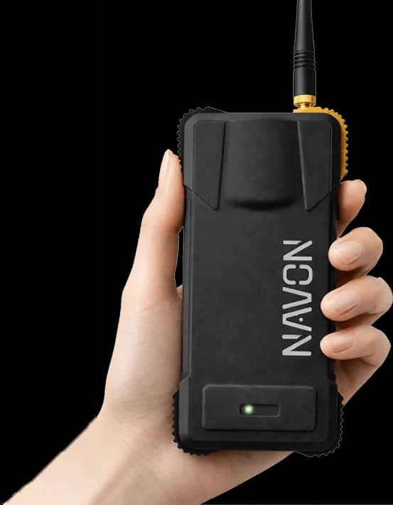
GLOBAL SATELLITE TRACKING
Every major constellation.
Pinpoint anywhere.
The Airace Navon connects with every major satellite system in the world. It pulls signals from global networks to find your exact location, providing pinpoint accuracy anywhere on Earth.
KEY BENEFITS
Worldwide Connections
The device links up with all major international satellite groups, ensuring your device stays connected no matter where you are working.
Constant Signal Strength
It tracks many data pathways simultaneously, which gives you a strong, highly stable connection even in tricky locations.
Pinpoint Accuracy
By combining multiple signals from satellites, it helps you map coordinates down to the exact spot with total confidence.
ALL-DAY POWER
24 hours RTK.
Zero compromises.
10,000mAh
Li-Ion Battery
24hr
RTK Runtime
15hr
Base Mode
<4hr
USB-C Charge
HARDWARE DESIGN
Compact agility.
Measure without boundaries.
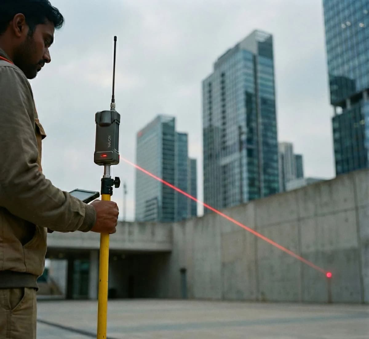
The Airace Navon completely changes what field gear looks like. It is incredibly sleek and fits a lot of power into a tiny, easy-to-carry frame. Because it can measure things from a distance, you no longer have to lug around bulky, heavy equipment on complicated job sites.
Streamlined Form Factor
An incredibly lightweight and balanced profile that reduces physical strain and ensures effortless handling throughout long shifts.
Point-and-Shoot Capability
An integrated aiming module allows you to capture out-of-reach locations securely from a distance, keeping you out of harm's way.
Weatherproof Protection
It is fully armored against harsh outdoor elements, meaning it keeps working through extreme heat or cold, heavy rain, and thick dust clouds.
TILT COMPENSATION
Smart Tilt Correction. Still Accurate.
The device features a built-in smart leveling system that automatically corrects for pole tilt. This allows you to capture highly reliable points even if your measurement pole is not held perfectly straight. By removing the need to constantly check a physical bubble level, it heavily speeds up your workflow in the field.
60°
Maximum tilt compensation
EASY SETUP
Ready in seconds.
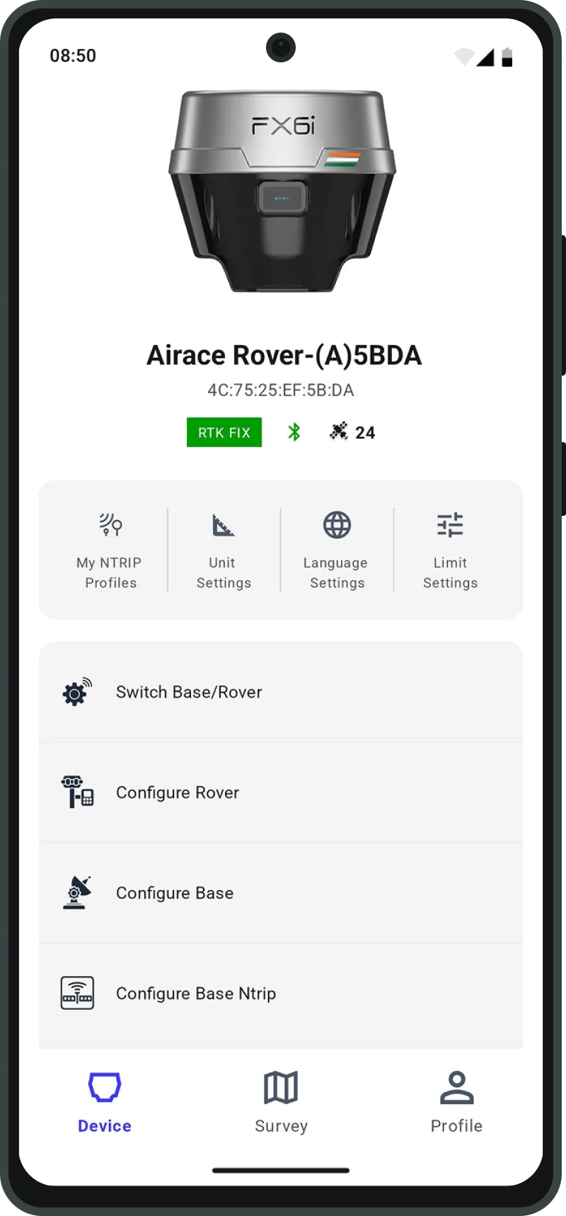
Power on, connect via Bluetooth, configure NTRIP, and you're surveying. No training required.
01
Pair
Enable Bluetooth & connect to Airace One app
02
Configure
Enter your NTRIP credentials or set as base
03
Survey
Collect points with centimeter accuracy
FIELD TO OFFICE
Airace One in the field.
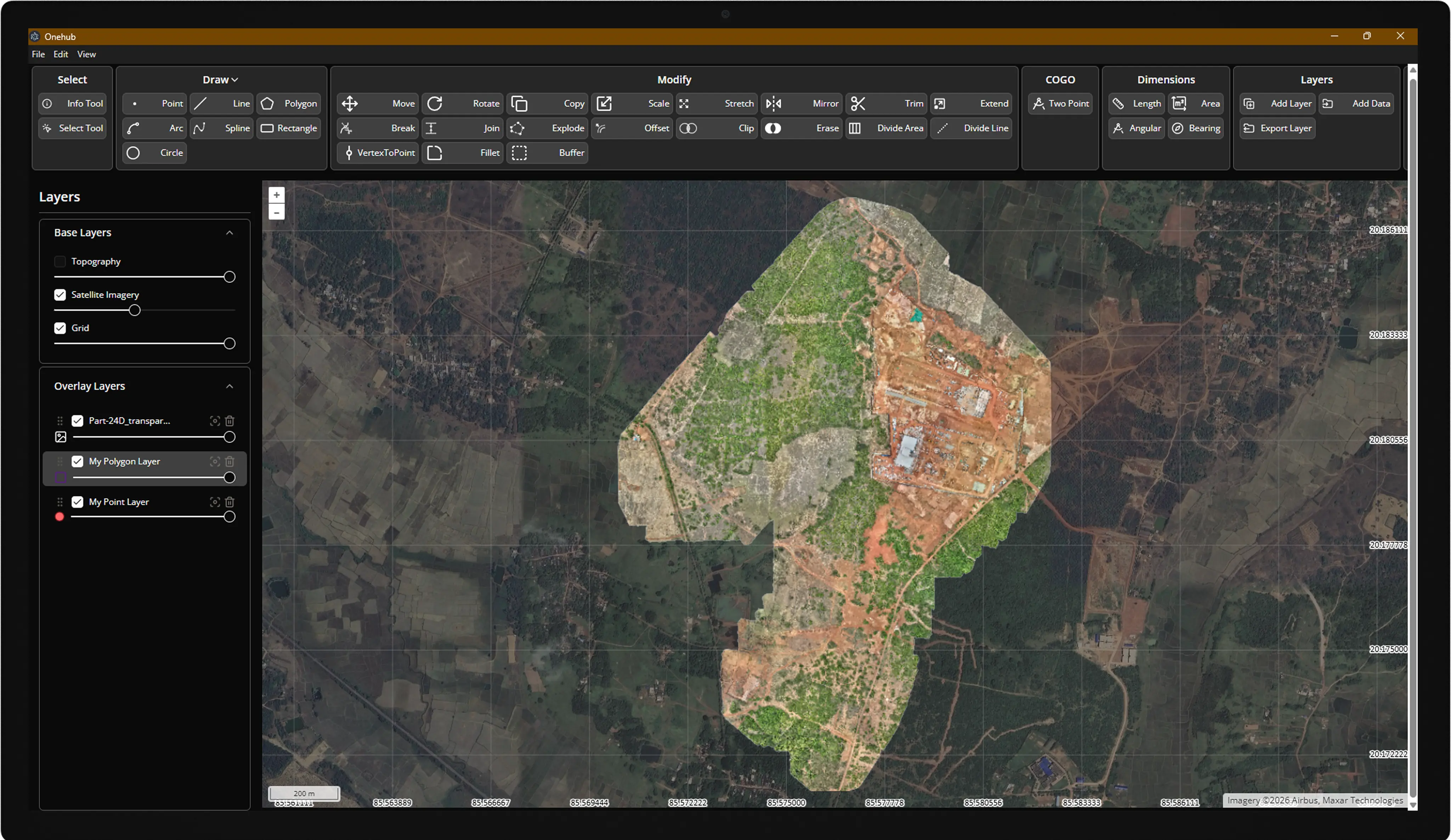
OneHub in the office.
Capture RTK points on your phone with Airace One — stakeout, collect, and export to CSV, DXF, KML, and Shapefile.
Sync to OneHub for live field tracking, import/export, surface analysis, and project delivery from one cloud console.
Receiver
- Signal Tracking
- GPS (L1, L1 C/A, L2, L2C, L2E, L2P, L5), GLONASS (L1, L2, L2 C/A, L2P, L3), BeiDou (B1, B2, B2a, B2b, B3), Galileo (E1, E5a, E5b, E5ab, E6), SBAS (WAAS, EGNOS, BDSBAS, MSAS, GAGAN, SDCM), QZSS (L1C/A, L1C, L5, L2C, L6), NavIC (L5), L-Band
- Channels
- 672+
- Update Rate
- Up to 20 Hz
- Memory
- 32 GB
- RTK & PPK Baseline
- Up to 100 km
- PPP Positioning
- Any point on Earth
- IMU Positioning
- 9 DOF, calibration-free (0°–60° tilt compensation in RTK mode) ± 5 mm + 0.4 mm/°
- Laser Positioning
- ≤ 7.5 cm (10 m range, ≤ 45° tilt in RTK mode)
Physical
- Dimensions
- 190 mm (H) × 40 mm (W) × 75 mm (L)
- Weight
- 400 g
- OLED Display
- No
- Operating Temperature
- -40 °C to +65 °C
- Storage Temperature
- -40 °C to +85 °C
- Water/Dust Proof
- IP67 (waterproof and dustproof)
- Humidity
- 5% to 95% non-condensing
- Dust Test Compliance
- IEC-60529
- Water Intrusion Test Compliance
- IEC-60529
- Vibration/Shock Compliance
- MIL-STD-810F
- Testing Lab
- NABL accredited
Data Format
- RTCM 2.x
- RTCM 3.0
- RTCM 3.1
- RTCM 3.2
- VRS
- NTRIP
- NMEA 0183
- LLH/XYZ
- RINEX
- NMEA
Communication
- Bluetooth
- Bluetooth 5.0
- Wi-Fi
- 2.4 GHz & 5 GHz, 802.11 b/g/n
- Network Communication
- Internal 4G (TDD-LTE/FDD-LTE/WCDMA/GPRS/GSM 900 & 1800 MHz, WCDMA 2100/900 MHz, LTE bands 1, 3, 7, 8, 20)
- USB Type C
- Charging & data transfer
- NMEA Output
- NMEA-0183 over Bluetooth
- Startup Time
- 5 seconds
- Internal UHF
- 1W
- Radio Range
- Up to 5 km
- Operating System
- FreeRTOS
Power
- Battery
- 10,000 mAh Li-Ion (included)
- Operating Period
- 24 hr (Rover) / 15 hr (Base)
- Charging Time
- < 4 hr
Positioning Performance
- High Precision Static
- H: 3 mm + 0.1 ppm / V: 3.5 mm + 0.4 ppm
- Fast Static/PPK
- H: 3 mm + 0.5 ppm / V: 5 mm + 0.5 ppm
- RTK
- H: 6 mm + 0.5 ppm / V: 10 mm + 1 ppm
- Tilt
- RTK + 5 mm + 0.4 mm/° (up to 60°) RMS
- RTK-Network/CORS
- H: 6 mm + 0.5 ppm / V: 10 mm + 1 ppm
- PPP
- 4 cm + 1 ppm or better with Network RT (H + V)
- Laser RTK
- ≤ 7.5 cm (10 m range, ≤ 45° tilt in RTK mode)
- DGPS Accuracy
- H: 0.25 m + 1 ppm / V: 0.40 m + 1 ppm RMS; SBAS typically < 2 m 3DRMS
- L-Band Accuracy
- H: 2 cm / V: 3 cm
FAQ
Frequently asked questions
Not sure which receiver fits your workflow?
Compare all Airace receiversarrow_forwardStart the conversation
Tell us about your project, our precision specialists will respond within one business day.