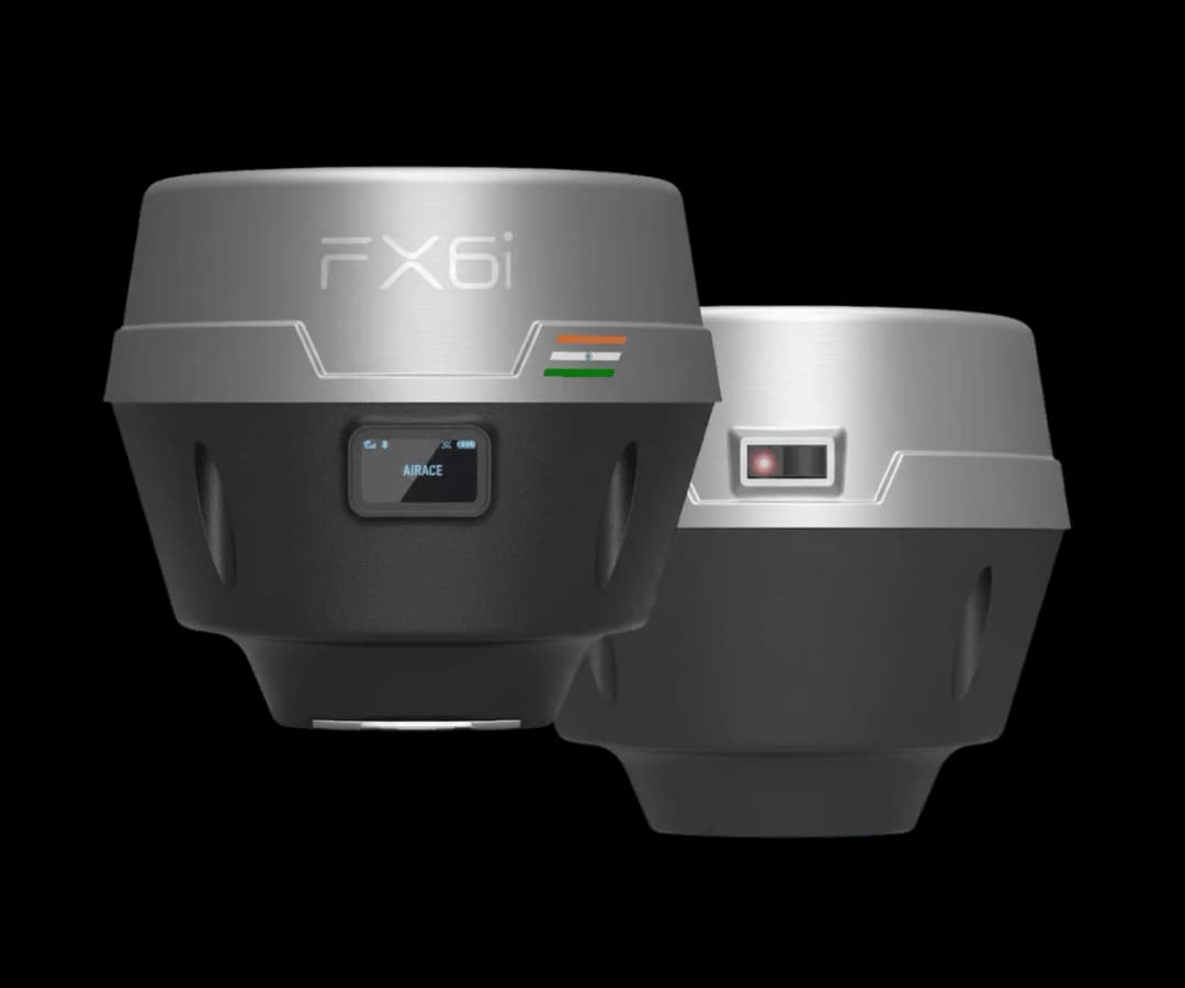
Airace FX6i Laser
The Next Generastion GNSS RTK Receiver
With Tilt Compensation & Laser
OVERVIEW
The FX6i-Laser advantage.
Compact size and lightweight
479 g with a 119.5 × 138.5 × 138.5 mm footprint — laser module included, still portable for long survey days.
High-precision positioning
RTK accuracy of H: 6 mm + 0.5 ppm / V: 10 mm + 1 ppm, with 1040+ channels and up to 100 km RTK & PPK baseline.
Anyone on the team can use RTK
5-second startup, Bluetooth 5.0 pairing, and an intuitive Airace One workflow — no specialist training required.
In-built laser distance module
Laser positioning ≤ 5 cm at 20 m range (≤ 45° tilt in RTK mode), plus 9-DOF IMU tilt compensation up to 60°.
EASY SETUP
Up and running in minutes.
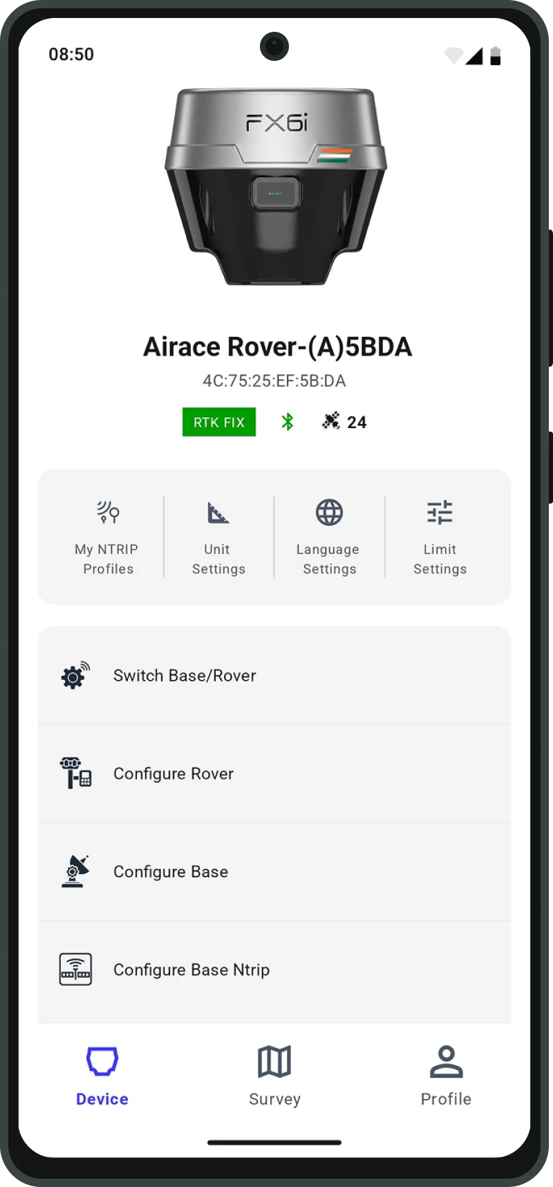
Pair over Bluetooth 5.0, configure NTRIP, and start collecting with a 5-second RTK startup.
01
Pair
Enable Bluetooth & connect to the Airace One app
02
Configure
Enter your NTRIP credentials or set as a base station
03
Survey
Collect points with RTK fix in 5 seconds
FIELD TO OFFICE
Airace One in the field.
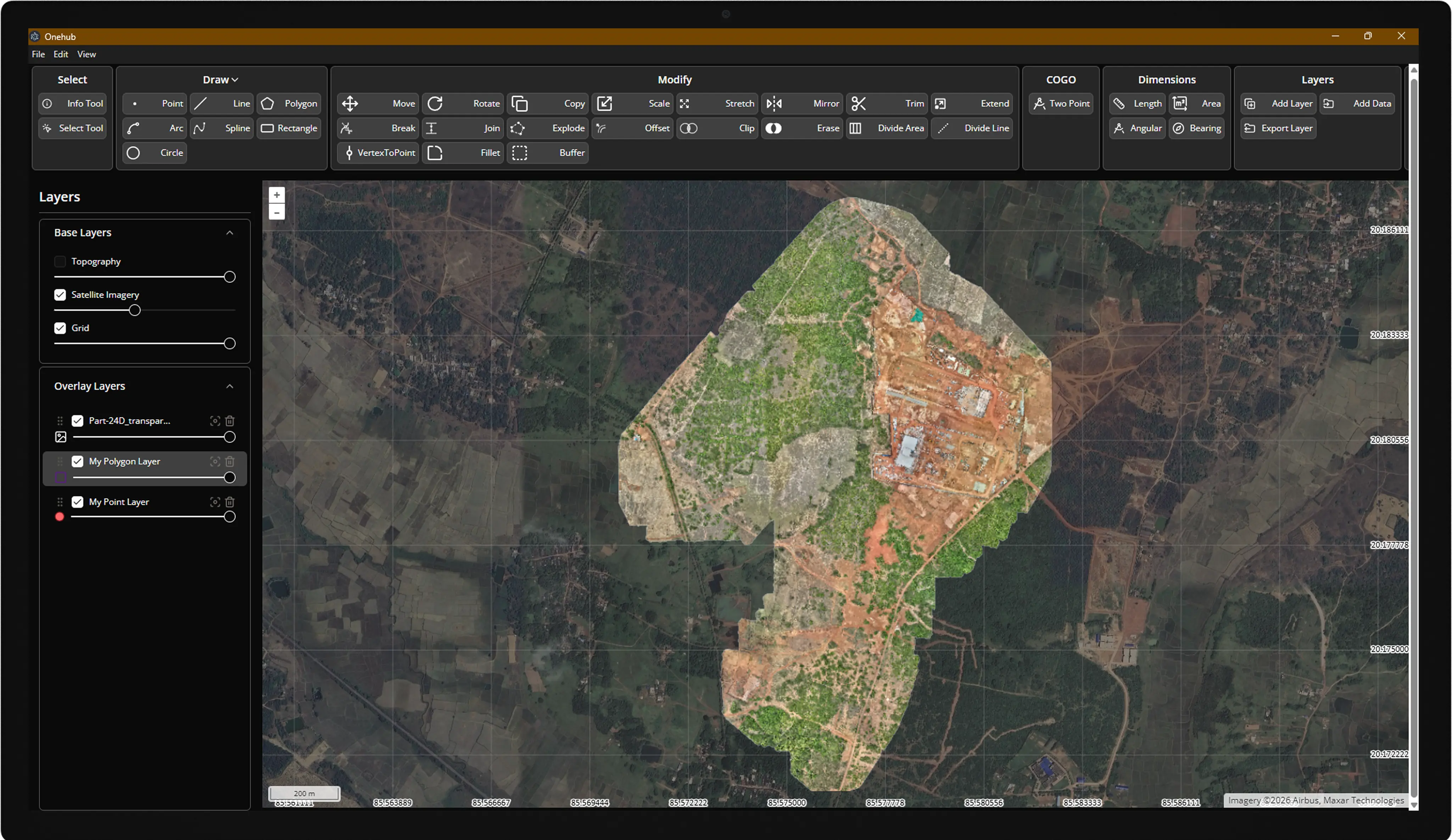
OneHub in the office.
Capture RTK points on your phone with Airace One — stakeout, collect, and export to CSV, DXF, KML, and Shapefile.
Sync to OneHub for live field tracking, import/export, surface analysis, and project delivery from one cloud console.
HARDWARE DESIGN
Built for the demanding field.
Ready for the unreachable.
Built for Tough Jobs. Ready for Anything.
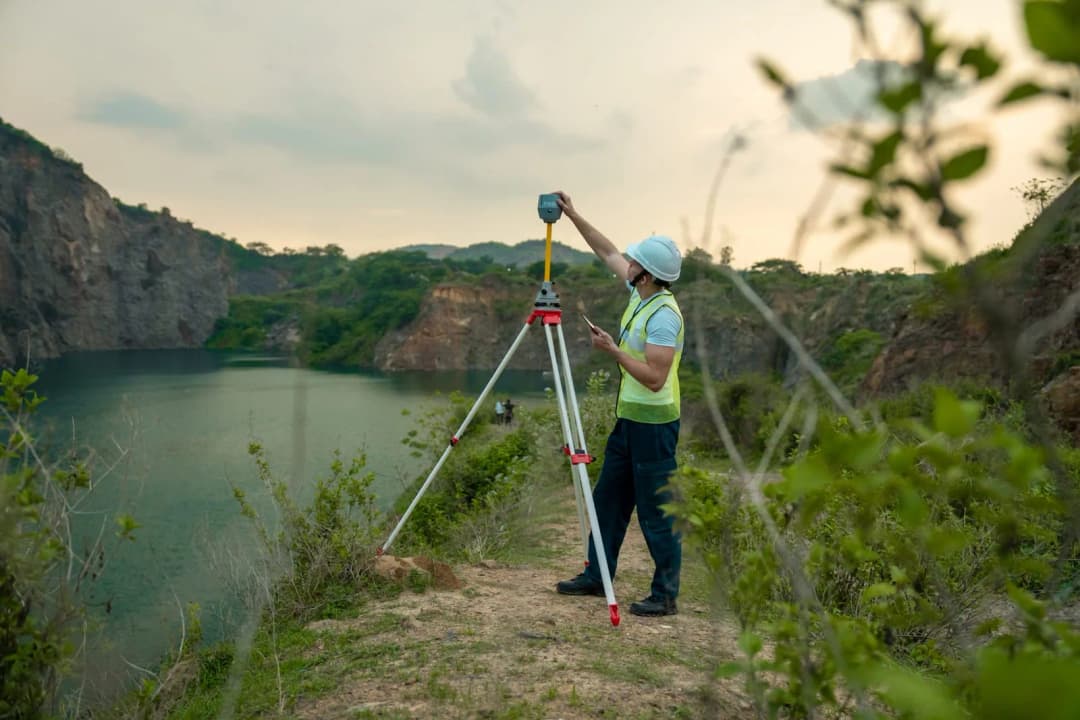
The Airace FX6i-Laser is built tough for fieldwork, especially when you need to measure places you can't actually reach. Thanks to its built-in laser, you can safely measure spots where a traditional measurement pole won't fit or can't go. Plus, it's lightweight and built to survive the harshest environments.
KEY BENEFITS
Laser-Assisted Measuring
Measure dangerous or blocked spots from a safe distance. You no longer have to risk your safety trying to hold a pole over hazardous terrain.
Weatherproof Design
The device is completely sealed to keep out heavy dust and pouring rain, so you can keep working no matter the weather.
Built to Last
It is protected against extreme heat and cold, and it is shock-tested to survive the drops, bumps, and rough handling that happen on a busy job site.
TILT COMPENSATION
Smart Tilt Correction. Still Accurate.
The device features a built-in smart leveling system that automatically corrects for pole tilt. This allows you to capture highly reliable points even if your measurement pole is not held perfectly straight. By removing the need to constantly check a physical bubble level, it heavily speeds up your workflow in the field.
ALL-DAY POWER
24 hours RTK. Zero compromise.
15 hr base mode · fully charged in < 4 hr via USB Type-C
RTK rover operation
Li-Ion battery (included)
charge cycles
What Our Users Say
Highly accurate
The Airace FX6i-Laser delivers consistent RTK and laser results that have greatly enhanced our surveying capabilities.
Not sure which receiver fits your workflow?
Compare all Airace receiversarrow_forwardReceiver
- Signal Tracking
- GPS (L1 C/A, L2, L2C, L2E, L2P, L5), GLONASS (L1, L2, L3 C/A, L2P, L3), BeiDou (B1, B2, B2a, B2b, B3), Galileo (E1, E5a, E5b, E5ab, E6), SBAS (WAAS, EGNOS, BDSBAS, MSAS, GAGAN, SDCM), QZSS (L1C/A, L1C, L5, L2C, L6), NavIC (L5, L-Band)
- Channels
- 1040+
- Update Rate
- Up to 20 Hz
- Memory
- 32 GB
- RTK & PPK Baseline
- Up to 100 km
- PPP Positioning
- Any point on Earth
- IMU Positioning
- 9 DOF, calibration-free (0°–60° tilt compensation in RTK mode) ± mm + 0.4 mm/°
- Laser Positioning
- ≤ 5 cm (20 m range, ≤ 45° tilt in RTK mode)
Physical
- Dimensions
- 119.5 mm (H) × 138.5 mm (W) × 138.5 mm (L)
- Weight
- 479 g
- OLED Display
- Yes
- Operating Temperature
- -40 °C to +65 °C
- Storage Temperature
- -40 °C to +85 °C
- Water/Dust Proof
- IP67 (waterproof and dustproof)
- Humidity
- 5% to 95% non-condensing
- Dust Test Compliance
- IEC-60529
- Water Intrusion Test Compliance
- IEC-60529
- Vibration/Shock Compliance
- MIL-STD-810F
- Testing Lab
- NABL accredited
Data Format
- RTCM 2.x
- RTCM 3.0
- RTCM 3.1
- RTCM 3.2
- VRS
- NTRIP
- NMEA 0183
- LLH/XYZ
- RINEX
- NMEA
Communication
- Bluetooth
- Bluetooth 5.0
- Wi-Fi
- 2.4 GHz, 802.11 b/g/n
- Network Communication
- 4G via certified Android controller (TDD-LTE/FDD-LTE/WCDMA/GPRS/GSM 900 & 1800 MHz, WCDMA 2100/900 MHz, LTE bands 1, 3, 7, 8, 20)
- USB Type C
- Charging & data transfer
- NMEA Output
- NMEA-0183 over Bluetooth
- Startup Time
- 5 seconds
- Internal UHF
- 1W
- Radio Range
- Up to 5 km
Power
- Battery
- 10,000 mAh Li-Ion (included)
- Operating Period
- 24 hr (Rover) / 15 hr (Base)
- Charging Time
- < 4 hr
Positioning Performance
- High Precision Static
- H: 3 mm + 0.1 ppm / V: 3.5 mm + 0.4 ppm
- Fast Static/PPK
- H: 3 mm + 0.5 ppm / V: 5 mm + 0.5 ppm
- RTK
- H: 6 mm + 0.5 ppm / V: 10 mm + 1 ppm
- Tilt
- RTK + 5 mm + 0.4 mm/° (up to 60°) RMS
- RTK-Network/CORS
- H: 6 mm + 0.5 ppm / V: 10 mm + 1 ppm
- PPP
- 4 cm + 1 ppm or better with Network RT (H + V)
- Laser RTK
- ≤ 5 cm (20 m range, ≤ 45° tilt in RTK mode)
- DGPS Accuracy
- H: 25 cm + 1 ppm / V: 40 cm + 1 ppm RMS; SBAS typically < 2 m 3DRMS
FAQ
Frequently asked questions
Start the conversation
Tell us about your project, our precision specialists will respond within one business day.