April 22, 2026
Best RTK GNSS Receiver for Land Surveying in India (2026 Guide)
By Swayambhu Mohanty, Co-founder, Airace Technologies
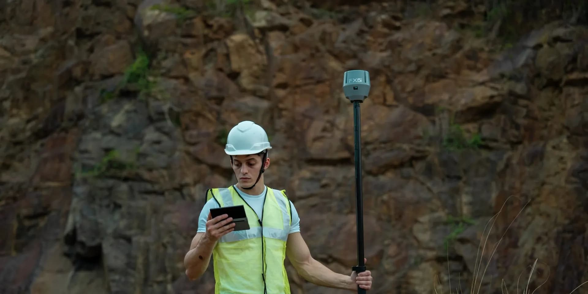
Choosing the right RTK GNSS receiver in 2026 is no longer just about centimetre accuracy, it's about NavIC support, tilt compensation, ruggedness for Indian field conditions, and a total cost of ownership that respects your survey budget. This guide walks through the criteria that matter most and recommends the receivers Indian surveyors are actually deploying today.
Why RTK GNSS is now the default for Indian land surveying
Conventional total stations and handheld GPS units still have a place, but RTK (Real-Time Kinematic) GNSS receivers have become the default for cadastral surveys, construction layout, road and rail alignment, mining volumetrics, agricultural plot mapping, and PMGSY/Jal Jeevan Mission projects. The reason is simple: a single rover can deliver 8–10 mm horizontal accuracy in seconds, work from a base station or a CORS/VRS network, and integrate directly with field software running on an Android device.
For Indian surveyors, three things have changed the buying decision in 2026:
- NavIC (IRNSS) is now mainstream, receivers that lock onto India's regional constellation deliver more reliable fixes in canopy, urban canyons, and the lower latitudes where GPS+GLONASS alone struggle.
- IMU-based tilt compensation means you no longer need to hold the pole vertical. Productivity gains are real, survey crews report 25–40% faster point capture.
- Make-in-India alternatives have closed the price-performance gap with imported brands, often at half the cost and with local support.
What to look for in an RTK GNSS receiver
1. Multi-constellation, multi-frequency
A modern receiver should track GPS (L1/L2/L5), GLONASS (L1/L2), Galileo (E1/E5a/E5b), BeiDou (B1/B2/B3), QZSS, and, critically for India, NavIC (L5/S-band). Multi-frequency tracking lets the receiver mitigate ionospheric errors and recover RTK fixes faster after signal loss.
2. Channel count
Look for 1000+ channels. Anything below 800 channels in 2026 is a previous-generation chipset. Higher channel count translates directly to faster initialization and more reliable fixes under canopy.
3. Accuracy
Survey-grade receivers should publish:
- RTK Horizontal: 8 mm + 1 ppm
- RTK Vertical: 15 mm + 1 ppm
- Static post-processed: 2.5 mm + 0.5 ppm
If a vendor only quotes "centimetre accuracy" without the ppm component, ask for the data sheet.
4. IMU tilt compensation
An integrated IMU (Inertial Measurement Unit) lets the rover stay accurate even when the survey pole is tilted up to 60°. This is essential when measuring building corners, fence lines, drains, or any point where holding a pole vertical is impractical.
5. Ingress protection & ruggedness
IP67 is the standard. Indian field conditions, monsoon, dust, 45°C heat, demand it. Look at operating temperature range (-40°C to +65°C) and a magnesium-alloy housing for drop resistance.
6. Battery life
Hot-swappable batteries delivering 10+ hours of RTK rover operation are now standard. Internal lithium-ion packs are convenient but limit a long survey day.
7. Connectivity & corrections
Modern receivers support 4G LTE for NTRIP corrections, UHF radio for base-rover work in remote sites, Bluetooth for controller pairing, and Wi-Fi for cloud upload. Built-in eSIM support is a 2026 differentiator.
8. Field software ecosystem
Hardware is half the equation. The data-collection app, point capture, stake-out, COGO, road design, point clouds, has to be intuitive and ideally bundled. A good app can save weeks of training time.
Recommended RTK GNSS receivers in India (2026)
1. Airace FX6i, the workhorse for cadastral and construction
The Airace FX6i is the most-deployed Made-in-India RTK receiver in 2026, with over 1,200 units in the field across surveying firms, government departments, and construction contractors. It tracks 1040+ channels across all major constellations including NavIC, delivers 6 mm + 0.5 ppm RTK horizontal accuracy, and runs for 24 hours on a single rover charge. IP67, MIL-STD-810F ruggedness, and direct integration with the Airace One field app make it a strong choice for daily survey work.
2. Airace FX6i-Laser, for inaccessible point capture
The FX6i-Laser is built on the FX6i platform with an integrated laser module (≤ 5 cm at 20 m, ≤ 45° tilt in RTK mode) for inaccessible points — across rivers, under power lines, on rooftops. It shares the FX6i's 1040+ channels, 6 mm + 0.5 ppm RTK horizontal accuracy, 24-hour rover battery, 100 km baseline, and IP67 rating. Weight is 479 g (vs 465 g for the FX6i) due to the laser module. Choose the Laser variant when you need distance measurement to points the pole cannot reach.
3. Airace Navon, flagship for the most demanding sites
The Navon is Airace's flagship, laser, IMU, and the latest generation chipset, built for the largest infrastructure projects, mining, and survey-of-India-grade work. If you need the absolute best fix availability under canopy and the longest battery life in a single rover, this is the receiver to specify.
4. Emlid Reach RS3 — best globally recognised value option
The Emlid Reach RS3 is the most popular receiver in the international value RTK segment and has a strong following among Indian surveyors doing drone survey GCP work and topographic surveys. It delivers 7 mm + 1 ppm RTK horizontal accuracy, multi-band tracking across GPS, GLONASS, Galileo, BeiDou, and SBAS, plus IMU tilt compensation up to 60°. The RS3 does not support NavIC. Its key strength is ecosystem: Emlid has one of the largest independent GNSS user communities globally, with extensive forum support, YouTube tutorials, and integration with third-party field apps (SurvCE, Field Genius, Mobile Topographer). For surveyors whose workflows depend on those integrations, the RS3 is a strong choice. See the full Airace FX6i vs Emlid RS3 comparison.
5. CHCNav i83 — established mid-range Chinese receiver
The CHCNav i83 has become one of the better-regarded mid-range receivers among Indian construction surveyors since 2019. It tracks 1,408 channels, delivers 8 mm + 1 ppm RTK accuracy, and includes IMU tilt compensation. The LandStar 7 software is considered capable, with mature road and construction layout tools. The i83 does not support NavIC, and its 14-hour rover battery life is shorter than the FX6i's 20 hours. Service and calibration go through the CHCNav distributor network, which can mean multi-week repair turnaround. The i83 is a credible option for firms already invested in the CHCNav/LandStar ecosystem. See the full three-way comparison.
6. Trimble and Leica — premium tier for enterprise projects
Trimble and Leica remain the benchmark receivers for major infrastructure, highway, and rail projects where downtime cost justifies premium hardware. Trimble R12/R780-class receivers and the Leica GS18T offer mature software ecosystems (Trimble Access, Leica Captivate), excellent canopy performance, and the longest track record in the industry. For government departments and large EPC contractors where a single lost survey day has significant project cost, the premium is defensible. For most independent surveyors, small firms, and multi-crew deployments, the premium is not economically justified by incremental accuracy differences.
Total cost of ownership matters more than sticker price
When evaluating receivers, calculate:
- Base + rover hardware cost
- Field controller (or BYO Android tablet)
- Field software licensing, annual or perpetual
- Calibration and recertification cost
- Repair turnaround and warranty
- Cost of NTRIP / CORS subscription if using network RTK
Made-in-India receivers like the Airace lineup typically deliver 40–55% lower 3-year TCO than imports, with same-day support from Indian engineering teams.
Quick decision matrix — all major options
| Use case | Recommended receiver | Why |
|---|---|---|
| Government DILRMP / NAKSHA cadastral | Airace FX6i | NavIC, GeM listing, Make-in-India eligibility |
| Construction layout & stake-out | Airace FX6i or CHCNav i83 | Both have capable construction workflows |
| Utility mapping / inaccessible points | Airace FX6i-Laser | Built-in laser + IMU on a single rover |
| Mining & large infrastructure | Airace Navon or Trimble R12 | Navon for value; Trimble for maximum ecosystem |
| Survey-grade accuracy with Make-in-India value | Airace FX6i | NavIC, GeM listing, local support |
| Drone survey GCP collection | Emlid RS3 or Airace FX6i | RS3 has more drone-workflow guides; FX6i adds NavIC |
| Third-party app (SurvCE, Field Genius) | Emlid RS3 or CHCNav i83 | Larger third-party integration ecosystems |
| Dense canopy / urban India sites | Airace FX6i or Leica GS18T | FX6i NavIC improves fix availability; Leica for premium canopy performance |
| High-value government infrastructure | Leica GS18T or Trimble R780 | Proven long-term reliability; enterprise support ecosystems |
| Multi-crew equipping (3+ rovers) | Airace FX6i | Lower capital outlay per rover vs imports |
Final word
The best RTK GNSS receiver for Indian land surveying in 2026 depends on your budget, use case, and whether NavIC support or ecosystem maturity matters more to your practice. For most Indian surveyors — freelancers, small firms, government project contractors — the Airace FX6i delivers the strongest combination of NavIC support, survey-grade accuracy, India pricing, and local service. For firms that need enterprise ecosystem depth or work internationally, Trimble and Leica remain the benchmark. For those already in the Emlid or CHCNav ecosystem, both remain credible options for specific workflows.
Talk to the Airace team for a field demo, compare the FX6i, FX6i-Laser, and Navon, or read the three-way Airace vs CHCNav vs Emlid comparison.